Dolomites Map

Dolomites Map: Exploring the Eastern, Southern, Northern, and Western Dolomites
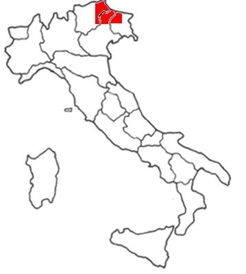
Why Dolomites Map? The Dolomites, a UNESCO World Heritage site, are a mountain range located in the northern Italian Alps. Known for their breathtaking beauty and unique geological features, the Dolomites cover an area of approximately 15,942 square kilometers (6,155 square miles) and can be divided into several distinct areas: the Eastern Dolomites Area, Western Dolomites Area, Southern Dolomites Area, and Northern Dolomites Area, which are made up of towns from different regions.
Dolomites Map: Regions That Make Up The Different Areas Of The Dolomites
Eastern Dolomites Area is made up of Towns from 3 regions
- Veneto: Particularly the Belluno province, including towns like Cortina d'Ampezzo, Auronzo di Cadore, and San Vito di Cadore.
- Trentino-Alto Adige: Extending into areas such as Val di Zoldo and the Cadore region.
- Friuli-Venezia Giulia: Including the Carnic and Julian Alps, which are part of the eastern Dolomites.
Western Dolomites Area is mainly made up of Towns from 2 regions.
- Trentino-Alto Adige: Mainly the Brenta Dolomites and the Adamello-Presanella group. This includes places like Madonna di Campiglio, Molveno, and Pinzolo.
- Lombardy: Sometimes considered part of the western fringe of the Dolomites, with areas like the Valcamonica.
Southern Dolomites Area is made up of towns from 2 regions
- Trentino-Alto Adige: Regions such as the Pale di San Martino.
- Veneto: Parts of the southern Belluno province and the Vicentine Alps, including towns like Feltre and Fiera di Primiero.
- South Tyrol (Alto Adige): Includes towns like Bressanone, Brunico, and Dobbiaco. Famous valleys like Val Gardena and Puster Valley also belong here.
These regions encapsulate the diverse and stunning landscapes of the Dolomites, making each area unique and worth exploring. And this Dolomites map is designed to provide a clear and concise overview of these regions, helping you understand their locations and main features.
The Maps of the Four Dolomites Area
Click on the link below to see the different maps of the four Dolomites Area Map:
- Map of the Northern Dolomites Area
- Map of the Southern Dolomites Area
- Map of the Western Dolomites Area
- Map of the Eastern Dolomites area

